Hyper-resolution crop yield estimates and extreme events crops shocks monitoring by integrating multiple SATellite data, modelling and combine harvester fleets
Project funded by ESA No. 4000137200/22/I-DT-lr – FUTURE EO-1 EO SCIENCE FOR SOCIETY PERMANENTLY OPEN CALL

Project description
The project will develop an EO-service for Hyper-resolution crop yield estimates and extreme events crops shocks monitoring by integrating multiple SATellite data and modeling, able to support farmers precision agriculture. This will be based on a dynamic calibration/validation system which takes advantage of the high spatial resolution (5-8m) of combined harvesters’ crop yield information. The system procedures will be substantially all based on available data from EO information and web-based available ground database, plus some specific ground data for models validation.
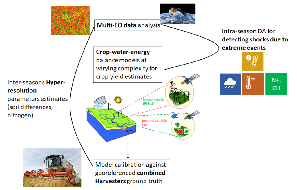
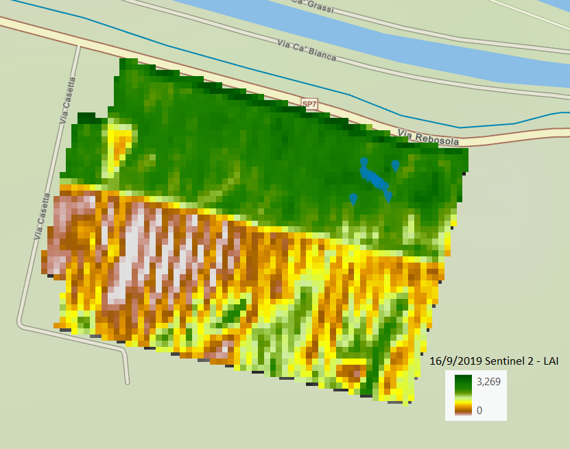
EO data in the different bands from different sensors will be used in order to retrieve leaf area index (LAI) and land surface temperature (LST) information from Sentinel 2 at 10 m of spatial resolution and also from the Third-party missions LANDSAT data at 30 to 60-100 m. The procedure will use the high-resolution remote sensing data for driving different water-energy-crop models based on two hypotheses: parameters-saving vs complex physical representation both for crop dynamic and evapotranspiration modeling.
Data assimilation procedures of EO data will be routinely implemented along the crop season with the objective of detecting and monitoring crop exposure to shocks due extreme events non-reproducible by the model alone which alter the canopy morphology and physiology, such as weather disasters (e.g. extreme heat or cold, waterlogging, ice), saline stress, plant diseases and insect pests, etc..
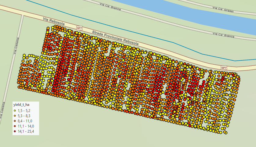
At the end of the crop season the modeled crop yield estimates will be calibrated / validated against ground yields maps from georeferenced combine harvesters, allowing producing hyper-resolution crop yield estimates and soil – vegetation parameters (5-8 m). The procedure will be integrated in a loop allowing to have hyper-resolution yields estimates between the different seasons.
Expected innovative products will respond to the call activity line “EO for a Resilient Society”, impacting directly on agricultural farmers and their associations in the case studies, but it will be immediately exportable to any area of the World where combine harvesters equipped with yield sensors and eventually quality sensors are used.
In this way, the project will deliver: i) a protocol for retrieving and using data collected by fleets of combine harvesters; ii) a tool for driving variable rate applications of water and fertilisers; iii) a tool for estimating the damages caused by shock events and the potential impact of climate change.
Project partners
- University of Padova (Italy)

- Politecnico di Milano (Italy)

- University of Valencia (Spain)

Experimental sites
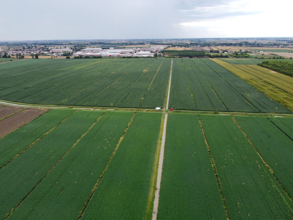
The proposed methodology will be applied in irrigated and not irrigated fields in the North of Italy over maize and winter wheat fields where combine harvester fleets have been operating for several years: the Ceregnano and the Ca’ Bianca sites.
Project results
The project has produced relevant advanced outcomes from both methodological and practical point of views:
1) a protocol for retrieving and using data collected by fleets of combine harvesters. This protocol could have an important impact on remote sensing applications by providing a huge amount of high-detailed “ground truth” data, useful for modelling calibration/validation;
2) a tool for driving variable rate applications of water; the tool could be further implemented in a web-based tool;
3) a tool for estimating the damages caused by shock events and the potential impact of climate change.
The project has demonstrated the potential of thermal sharpening techniques by utilizing Sentinel-2 data to enhance the resolution and accuracy of Sentinel-3 data.
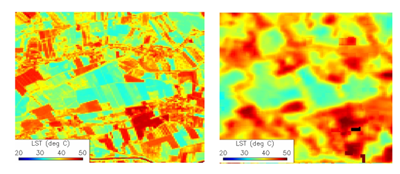
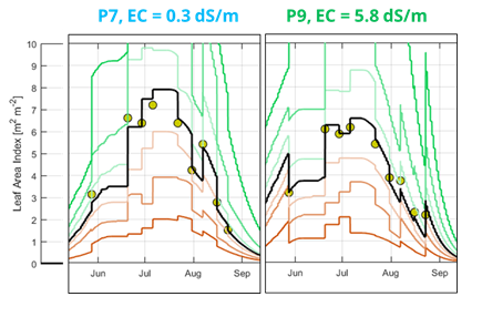
Data assimilation procedures of EO data were routinely implemented along the crop season with the objective of detecting and monitoring crop exposure to shocks due extreme events non-reproducible by the model alone which alter the canopy morphology and physiology, such as extreme heat and saline stress. LAI leaf area index and land surface temperature (LST) from multiple-remote sensing data were assimilated to improve both the crop evapotranspiration and growth dynamics.
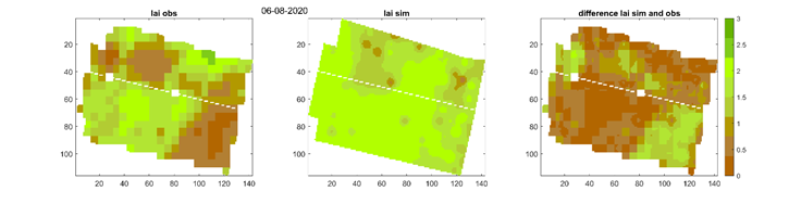
At the end of the crop season the modeled crop yield estimates were calibrated / validated against ground yields maps from georeferenced combine harvesters, allowing producing hyper-resolution crop yield estimates and soil – vegetation parameters (5-8 m).
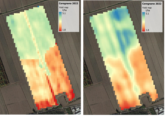
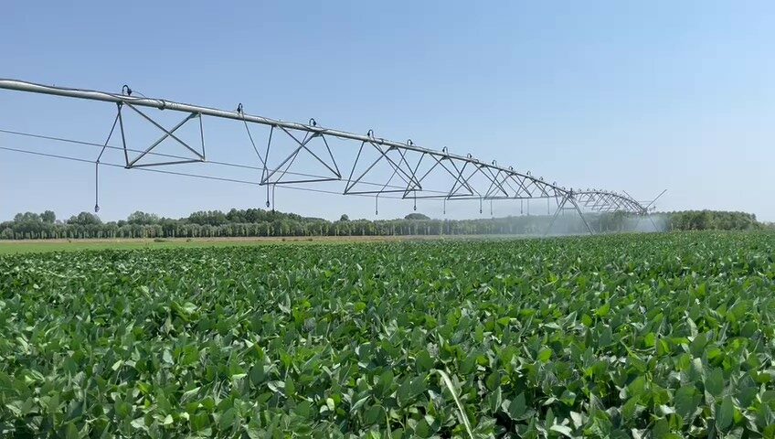
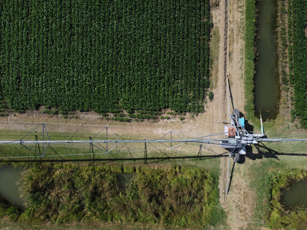
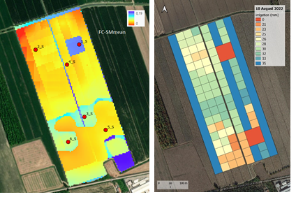
The FEST-EWB-SAFY model, one calibrated on satellite LST and LAI data, was also employed to estimate the irrigation prescription maps to drive a variable rate irrigation pivot system during the 2022 crop season in Ceregnano.
Acknowledgements
We would like to thank Veneto Agricoltura, the extension service of Veneto Regional Government, which was involved in the project by hosting one of the two monitoring activities. Interaction with the Interreg Italy-Croatia project “SeCure” was also created on the Ca’ Bianca site. Finally, representatives of Confagricoltura Veneto and Claas Italia were informed on the project progress.